The Bury Farm Project at Stapleford, Cambridgeshire
The relationship between people and riverine landscapes has been initiated at the site of Bury Farm, Stapleford in Cambridgeshire. The site, on the edge of a medieval church estate and modern Cambridge village is looked down upon from Wandlebury hillfort and occupies the lower and middle terraces of the River Granta. We have a developing picture of prehistoric occupation on the chalks surrounding Cambridge, but often our knowledge of how people used the rivers is shaped by the current landscape of urban and farming developments.
The 'River' Granta, as it passes through Stapleford and Bury Farm, is now little more than a highly channelised stream, however geoarchaeological and survey data conducted to date indicate the River was once much wider in the past. Test-pitting in 2011 and 2012 found a range of materials dating from the Neolithic to the present. During the 2013 field season, our Part IIA students conducted targeted survey and found evidence of a small oxbow on the river at Bury Farm.
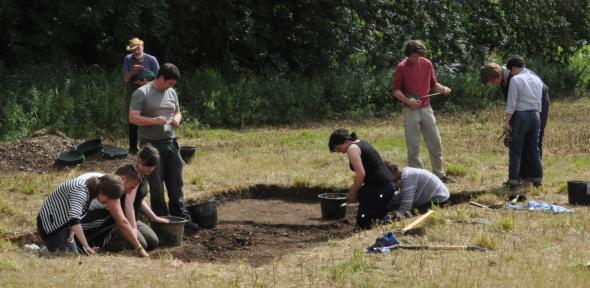
 In August 2013 we excavated in this area in order to understand when it was formed, how it changed the landscape and how people utilised this environment in prehistory. Evidence on the first terrace of the river found Mesolithic-Early Neolithic flints, indicating activity close to the river. What was even more interesting and surprising was the lack of any further material until the 19th century. It may be that that sometime before the Bronze Age, the oxbow formed or the area became too damp for occupation until the river was channelised in the recent past. In 2014 we returned to this area and located the edge of the ancient river - we hope to be able to date it from the organic material in the palaeochannel.
Other excavation during the 2014 field season provided some unexpected results with evidence of more recent attempts to shape and modify this landscape into what we see now. The team uncovered a defunct drainage system (Victorian to pre-WWII) near the old channel and earlier field boundary ditches higher on the chalk which might date as early as the late Medieval period. In 2015 we will return to excavations farther up on the chalks and conduct more rigorous geophysical survey of the lower fields in order to fill in the time line between the Mesolithic and more recent narratives we are starting to see.
This project has been evolving alongside teaching and community aspects. Test-pitting and survey has been conducted since 2011 with the ACE foundation British Archaeology summer schools and the University of Cambridge student community. As the project developed in 2013 and 2014 we have conducted targeted excavation along the lower edge of the current river and near the early channels. As part of the excavations we have invited interested volunteers to join us for a week and hold several outreach events including half-day excavation experiences for children and open days for the general public. See our link below for more information.
Team Members
Sheila Kohring
Katherine Boyle
Kate Boulden
Charly French


