Creating three-dimensional images of rock carvings

Recording
The rock surface is covered with measured points of fixed interval. The height and grid location of each point is recorded electronically using a theodolite, which measures distance by using a laser beam reflected off a prism at the chosen point. In the above photograph Dr. Corinne Anderson is working the theodolite (total station), whilst Ms. K. Szczesna holds the prism (fixed to a rod) at the selected point.

Processing
Once all the measurements have been recorded electronically, the data is transferred to a computer. Using GIS software, each point is recreated 'virtually'.
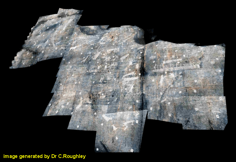
First the surface of the rock is reconstructed (1). Then digital photographs of the rock surface are superimposed, and moulded to the contours (2).
Reconstruction
The finished three-dimensional image shows the rock carvings with respect to the rock surface. This image can be manipulated to show the images visible from different viewing points, and under different light conditions.
Return to home page.
All contents © L. Janik - website by rmb51@cam.ac.uk - September 2003


