Northeast Algonquin Palaeolake and Environmental Assessment (NAPLEA)
Research Context
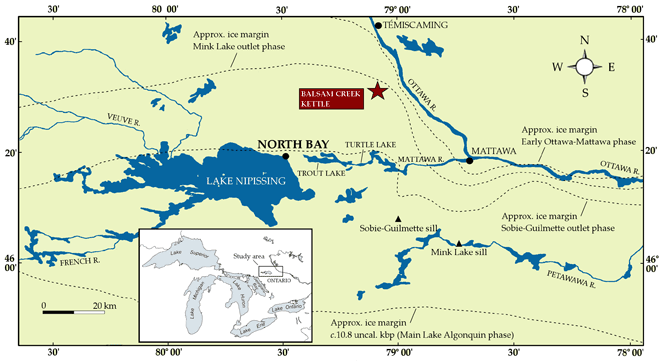
 Lake AlgonquinLake Algonquin was the most extensive glacial lake in the Great Lakes region. During the Main Phase of its life (c.11-10.5 uncal. kbp) its waters covered an area greater than 120,000 km2. In addition to filling the basins of two of the Great Lakes (Huron and Michigan), Lake Algonquin also incorporated the smaller Nipissing and Simcoe lakes in north and central Ontario, together with large tracts of adjacent land. Algonquin may have ceased to be ice-dammed as early as 11.3 uncal. kbp, but the crucial and rapid drop in water level marking the end of the Main Phase is thought to have occurred between 10.5 and 10 (uncal.) kbp, as retreat of the Laurentide ice sheet opened northern channels into the Mattawa and Ottawa River valleys.
The onset of deglaciation and sequence of environmental change in northern Ontario is known from a small number of sediment cores from lakes and marshes scattered across in this part of the province. These have made it possible to track changes in local and regional habitats into the Early Holocene. The number of well-dated sequences, though, remains very limited over such a vast area. Equally, while there has been almost a century of research into the nature, extent and evolution of Lake Algonquin (particularly along its southern shores), no absolute chronology yet exits of the changes in water level through its primary drainage route eastwards of the modern city of North Bay, Ontario. Obtaining an accurate age for the opening of this drainage outlet and its history has long been recognised as essential to building a robust chronology of deglaciation in the upper Great Lakes region.
 Last updated on 04/08/2011
Information provided by Ryan Rabett
08.03.2011
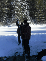
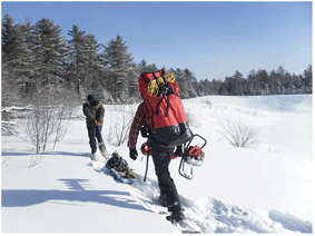 Setting off on the first day's collection, Balsam Creek kettle, 16th January, 2011. (Photograph: T. Rabett)Coring at the Balsam Creek kettle lake took place over three days (16th, 20th and 30th January, 2011). A total of four cores were extracted using an Eijkelkamp piston auger. These comprised two paired sequences to ensure overlapping between individually cored sections. All work was conducted in the north-central part of the kettle; an area identified in 2010 to contain deep sedimentary deposits. The first two cores were 204 cm and 297.5 cm in length respectively. These were shipped to Queen's University, Belfast where they are to be split. One half will be analysed there, at the School of Geography, Archaeology and Palaeoecology. Complementary analyses will be made on the other half of the core through the McDonald Institute for Archaeological Research, University of Cambridge. The second two cores were 262 cm and 363.5 cm in length respectively. These were shipped to the Dept. of Earth and Environmental Sciences, University of Waterloo for parallel analysis in Ontario.
Last updated on 04/08/2011
Information provided by Ryan Rabett
Ontario Ministry of Natural Resources
Fisheries and Oceans Canada
McDonald Institute for Archaeological Research, D M McDonald Grants and Awards Fund
Joanna Appleby
Phil Kor
Mike Lewis
Tina Rabett
Ben Verzijlenberg
Last updated on 04/08/2011
Information provided by Ryan Rabett
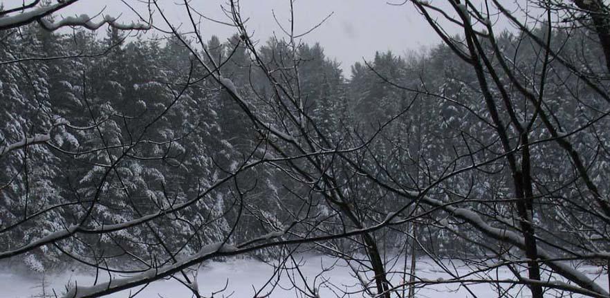
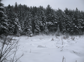
 The cores were taken from a steep-sided wet kettle (46°28'58.7"N, 79°09'04.1"W) north-east of the city of North Bay, near the hamlet of Balsam Creek (Highway 63) (Ontario Ministry of Natural Resources map 20 17 6400 51400). The kettle is located within a glacial outwash plain or sandur that has its apex to the north and spreads out to a maximum width of c.6 km south of this position. The rim of the kettle is at c.359 m asl. Its current shoreline (c.332 m asl.) encompasses an area of 1.48 acres, containing an ephemeral lake that comprised a single standing pool near the middle of the kettle in late summer 2010. The lake does not appear to be fed by any external water-sources aside from that generated by snow-melt and superficial slope-wash. The location and situation of the Balsam Creek kettle has for some time marked it as a likely repository of information pertaining to the opening and evolution of the North Bay Outlet.
Last updated on 04/08/2011
Information provided by Ryan Rabett
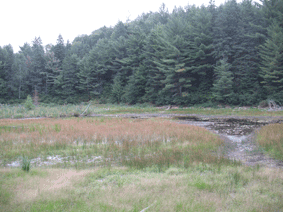
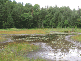
 Preliminary assessment of exposed water-logged lake-bed deposits by project personnel during the summer of 2010 has established that they exceed 3 m in depth. On this evidence the prospects for the recovering an intact and useful sequence look positive. Field collection of the sediment cores took place during a short field-season in January 2011, to take advantage of a winter collection window. Analysis of the cores will be carried by graduate students based at the participating universities.
Last updated on 04/08/2011
Information provided by Ryan Rabett
 The inter-related objectives for the NAPLEA programme of research will be to use palynological and other proxy evidence to produce a detailed study that will track changes in vegetation, water depth and temperature as the North Bay Outlet evolved. Secondly, it will place the data generated into a wider context. In addition to its importance locally and regionally, the accurate dating and characterization of these changes will also make a significant contribution to our understanding of how melt-water pulses may have forced climatic downturns in the North Atlantic realm as a whole. For the period in question this would include, particularly, the Preboreal Oscillation and the '8.2 Event'. The creation of a detailed picture of local environmental conditions and lake phases during the early deglacial period will also provide the environmental back-bone for a new programme of archaeological investigation that will look to trace the initial spread of palaeo-indians into central and north-eastern Ontario.
The Lake Algonquin shoreline has been a major focus of archaeological efforts to document the earliest human occupation of southern Ontario. Archaeological data from further north is much more limited, with currently no recorded sites from the opening millennia of the Holocene in north-eastern Ontario. Surveys, however, have been limited and the potential for a human presence here and its archaeological recovery is indicated most notably through the well-stratified and recently re-analysed open-air site of Sheguiandah (c.9.4 uncal. kbp) on Manitoulin Island, north-central Ontario. In addition, underwater archaeology in upper Lake Huron is beginning to reveal features that are credibly interpreted as structures used in caribou hunting from the period between 10 and 7 uncal. kbp.
Last updated on 04/08/2011
Information provided by Ryan Rabett
 NAPLEA is a joint UK-Canadian research venture. Field survey work and sediment core collection were organised and undertaken by Ryan Rabett (University of Cambridge) in close consultation with Chris Hunt (Queen's University, Belfast) and Paul Karrow (University of Waterloo, Ontario). Laboratory analysis is being administered by RR, CH and PK in association with Rhiannon Stevens (University of Cambridge). UK lab work is being conducted by Rachel Patterson (MSc student) at Queen's and by Alex Pryor (doctoral candidate: submitted) at Cambridge. Details concerning the analysis of the Waterloo cores are pending. Basic funding for this project was awarded to RR through the D M McDonald Grants and Awards Fund, University of Cambridge. The project has the approval by the Ontario Ministry of Natural Resources and Fisheries and Oceans Canada.