skip to content

Department of Archaeology


Biography

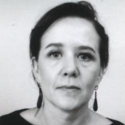
I am the remote sensing digital data co-ordinator and project manager of the Mapping Africa’s Endangered Archaeological Sites and Monuments (MAEASaM) project.

I studied Classics and Archaeology at the University of Padova (Italy) and hold an MSc in GIS and Remote Sensing (2001) and PhD in Archaeology (2011) from the University of Cambridge. I was a fixed term lecturer in GIS at the University of Leicester in 2006, and a lecturer in computing archaeology at the University of Botswana from 2007 to 2012. Before joining the McDonald Institute in September 2020, I was a Senior lecturer in GIS in the School of Geography, Archaeology and Environmental Studies at the University of the Witwatersrand (2013-2020). I have directed archaeological research projects in Libya, Sudan, Botswana and South Africa. I am a registered Professional GIS practitioner with the South African Geomatics Council.


Research

I am an Africanist and archaeologist with a specialisation in GIS and remote sensing. My research examines short- and long-term transformations of cultural landscapes across different environments, cultures and time periods through multidimensional integrative approaches. Recent and current field research includes projects on settlement and landscape dynamics of the past 500 years in Northern and Southern Africa, where I have developed various digital expert and participatory approaches for mapping, analysing, managing and disseminating cultural heritage.

In my research I engage with legal and ethical issues around the use and dissemination of spatial information, in particular the need for inclusive, open and low resource environments in the creation of sustainable spatial data infrastructures.

I am currently a principal investigator in the collaborative project metsemegologolo - a multimodal digital platform for the exploration of African urbanisms - (https://metsemegologolo.org.za/) based at the University of the Witwatersrand and funded by an African Digital Humanities Mellon grant and the co-Pi of the AHRC funded project Reframing the African past: using museum collections and digital storytelling to increase accessibility for and participation by low-resourced audiences

Key Publications

Key publications: 


Journal articles

  • Thabeng, O.L., Elhadi A., Merlo,S. 2023. Evaluating the performance of geographic object-based image analysis in mapping archaeological landscapes previously occupied by farming communities: a case of Shashi–Limpopo confluence area. Remote Sensing 15, no. 23: 5491. https://doi.org/10.3390/rs15235491
  • Ochungo, P., Khalaf, N., Merlo, S., Beldados, A., M’Mbogori, F.N., Tiki, W., Lane, P.J. 2022. Remote sensing for biocultural heritage preservation in an African semi-arid region: a case study of indigenous wells in northern Kenya and southern Ethiopia. Remote Sensing14, 314. https://doi.org/10.3390/rs14020314
  • Biagetti S., Alcaina-Mateos J., Ruiz-Giralt A., Lancelotti C., Groenewald P., Ibañez-Insa J.,  Gur Arie, S., Morton, F. and Merlo, S. 2021 Identifying anthropogenic features at Seoke (Botswana) using pXRF: Expanding the record of southern African Stone Walled Sites. PLoS ONE 16(5): e0250776. doi:10.1371/journal.pone.0250776
  • Morrison K.D., Hammer E., Boles O., Madella M., Whitehouse N., Gaillard M.-J., Bates J., Vander Linden M, Merlo, S. et al. 2021. Mapping past human land use using archaeological data: A new classification for global land use synthesis and data harmonization. PLoS ONE 16(4): e0246662. https://doi.org/10.1371/journal.pone.0246662
  • Thabeng O.L., Merlo S., Adam E. 2020. From the bottom up: assessing the spectral ability of common multispectral sensors to detect surface archaeological deposits using field spectrometry and advanced classifiers in the Shashi-Limpopo confluence area. African Archaeological Review 37: 25–49.
  • Thabeng O. L., Adam E., Merlo S. 2019. Spectral discrimination of archaeological sites previously occupied by farming communities using in situ hyperspectral data. Journal of Spectroscopy 2019. Article ID: 5158465.  DOI: 10.1155/2019/5158465
  • Thabeng O. L., Merlo S., Adam E. 2019. High resolution remote sensing for the prospection of archaeological sites’ markers: the case of dung deposits in the Shashi-Limpopo Confluence area (Southern Africa). Journal of Archaeological Science 102: 48–60.
  • Biagetti S., Merlo S., Adam E.; Lobo A.; Conesa F.C., Knight J., Bekrani H., Crema E.R., Alcaina-Mateos J.; Madella M. 2017. High and medium resolution satellite imagery to evaluate late Holocene human–environment interactions in arid lands: a case study from the Central Sahara. Remote Sensing 9 /4/351. DOI: 10.3390/rs9040351 
  • Stratford D. J., Merlo S., Brown S. 2016. The development of a new geospatial framework for the palaeoanthropological site of the Sterkfontein Caves, Cradle of Humankind, Gauteng, South Africa. Journal of Field Archaeology 41/2: 211–221.
  • Kleinitz C. & Merlo S. 2014. Towards a collaborative exploration of community heritage in archaeological salvage context: participatory mapping on Mograt island, Sudan. Der Antike Sudan. Mitteilungen der Sudanarchäologischen Gesellschaft zu Berlin 25: 161–175
  • Mothulatshipi S. & Merlo S. 2013. Can we learn anything from the past? Long term histories of land use and rapid urbanization of rural areas: the case study of Gaborone and its hinterland. Botswana Journal of Technology 22/2: 40–48.
  • Merlo, S., Hakenbeck, S. and Balbo, A. 2013.   Desert Migrations Project XVIII: The archaeology of the northern Fazzan, a preliminary report. Libyan Studies 44: 141-162.
  • Merlo, S., Hakenbeck, S. and Balbo, A. 2008. DMP IV:2008 fieldwork on historic settlement in the Wadi ash-Shati and the Dawada lake villages. Libyan Studies 39: 295-298.
  • Mattingly, D. Lahr, M., Armitage, S., Barton, H., Dore, J., Drake, N. Foley, R., Stock, J., White, K., Merlo, S. 2007. Desert migrations: people, environment and culture in the Libyan Sahara. Libyan Studies 38: 115-156.

Articles in peer reviewed conference proceedings

  • Els, A., Merlo, S., and Knight, J. 2015. Comparison of two satellite imaging platforms for evaluating sand dune migration in the Ubari Sand Sea (Libyan Fazzan), International Archives of Photogrammetry, Remote Sensing and Spatial Information Science, XL-7/W3, 1375-1380, doi:10.5194/isprsarchives-XL-7-W3-1375-2015.
  • Merlo, S. and Shell, C. 2005. Developing a multidimensional GIS framework for archaeological excavations. CIPA 2005 XX International Symposium Proceedings. Turin, 26th September-1st October 2005, online publication. 
  • Merlo, S. 2004. The “contemporary mind”. 3D GIS as a challenge in excavation practice. In Ausserer, K.F., Borner, W. Goriany, M. and Karlhuber-Vuckly, L. (eds.) Enter the Past. The E-way into the four Dimensions of Cultural Heritage. CAA2003, Computer Applications and Quantitative Methods in Archaeology. BAR International Series 1227, Archeaeopress, Oxford, pp. 276-279. 

Books

  • Knight, J., Merlo, S., Zerboni, A. (eds) 2023. Landscapes and Landforms of the Central Sahara. World Geomorphological Landscapes. Springer, Cham
  • Merlo, S. 2016. Making visible. Three-dimensional GIS in archaeological excavation. S2018. BAR International Series, Oxford. 

Book chapters

  • Merlo, S. 2023. Oases occupation. In: Knight, J., Merlo, S., Zerboni, A. (eds) Landscapes and landforms of the Central Sahara. World Geomorphological Landscapes. Springer, Cham. https://doi.org/10.1007/978-3-031-47160-5_18
  • Knight, J., Merlo, S. 2023. The development and characteristics of sand seas in the Central Sahara. In: Knight, J., Merlo, S., Zerboni, A. (eds) Landscapes and landforms of the Central Sahara. World Geomorphological Landscapes. Springer, Cham. https://doi.org/10.1007/978-3-031-47160-5_9
  • Knight, J., Merlo, S. 2023. Geoheritage and cultural heritage of the Central Sahara: conservation threats and opportunities. In: Knight, J., Merlo, S., Zerboni, A. (eds) Landscapes and landforms of the Central Sahara. World Geomorphological Landscapes. Springer, Cham. https://doi.org/10.1007/978-3-031-47160-5_23
  • Rubin, M., Samson, M., Butcher, S., Joffe, A., Merlo, S., Smith, L., Wafer, A. 2020. Investigating infrastructures of urban inequality. In Francis, D., Valodia, I. and Webster, E. (eds.) Inequality Studies from the Global South. Taylor and Francis, London, pp.163-183
  • Mattingly, D., Merlo, S., Mori, L. and Sterry, M. 2020. Garamantian oasis settlements in the Sahara. In Mattingly, D. and Sterry, M. (eds) Urbanisation and State Formation in the ancient Sahara and beyond. Cambridge University Press, Cambridge, pp. 57-111
  • Merlo, S. 2019. Environmental mapping: past and present. In Knight, J. and Rogerson, C. (eds.) The geography of South Africa: contemporary changes and new directions. Springer Publishers, pp. 15-26

Teaching and Supervisions

Research supervision: 


I am currently supervising the following PhD students:


Recently completed PhD:

  • Samkelisiwe Khanyile (2023) A GIS framework for the integrated conceptualisation, analysis and visualisation of Gauteng’s complex historic and contemporary post-mining urban landscape (co-supervised with Amanda Esterhuysen, WITS University and Clare Kelso, University of Johannesburg)
  • Mncedisi Siteleki  (2021) Rethinking the settlement patterns of Late Farming Communities in southern Africa: a reflexive digital approach (co-supervised with Per Fredriksen, University of Oslo, Karim Sadr, WITS University and Enrico Crema, University of Cambridge)
  • Ingrid Watson (2021) Yesterday’s World, Tomorrow’s Landscape. Modelling landscape change in the Free State Goldfields, and implications for the development of resource regions (co-supervised with Daniel Limpitlaw, WITS University)
  • Keneiloe Molopyane (2021). Patterns of antemortem skeletal trauma in 20th century South African cadaveric populations: an analysis of secular trends in trauma expression (co-supervised with Alan Morris, UCT and Patrick Randolph-Quinney, Northumbria University)
  • Lokwalo Thabeng (2020)  Remote sensing survey of archaeological sites in the Shashi-Limpopo confluence region (co-supervised with Elhadi Adam, WITS University)

Recently completed Master by research:

  • Maryke Horn (2021) Clarifying the stratigraphic boundary between Member 4 and Member 5 of the Sterkfontein Caves, South Africa: a three-dimensional spatial analysis of hominin fossils and stone tools (co-supervised with Dominic Stratford and Kathleen Kuman, WITS University)
  • Kuni Mosweu (2019) A study of silcrete raw material acquisition in the Howiesons Poort at Klasies river using GIS catchment analysis techniques (co-supervised with Sarah Wurtz and Silje Bentsen)

Job Titles

Senior Research Associate, McDonald Institute for Archaeological Research

General Info

Not available for consultancy
Research Expertise / Fields of study: 
Archaeological Theory
Computational and Quantitative Archaeology
Cultural Heritage

Contact Details

McDonald Institute for Archaeological Research, Downing Street
sm399 [at] cam.ac.uk
Cambridge
CB2 3ER

Affiliations

Person keywords: 
GIS
Remote sensing
African archaeology
Digital humanities
Subjects: 
Archaeology
Themes: 
Environment, Landscapes and Settlement
Heritage
Geographical areas: 
Africa