


MAHSA
Mapping Archaeological Heritage in South Asia

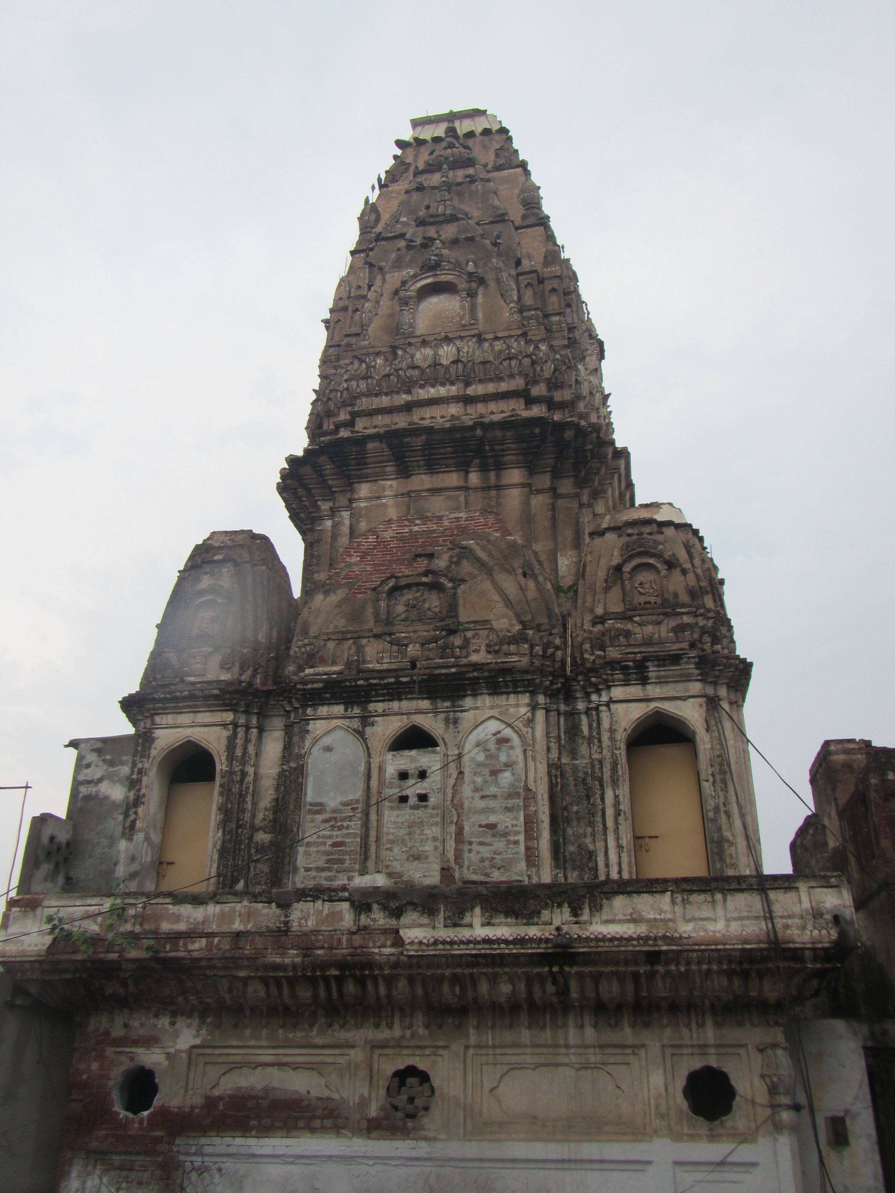
The landscapes of India and Pakistan guard histories that are vulnerable to time and change. Discovering, documenting and disseminating knowledge of archaeological heritage at danger will help to protect it for the future.
Why is this important?
The ground beneath our feet is continually transforming under the influence of human activity and nature. Thousands of archaeological sites face threats that could break the chain of knowledge with both our near and distant past.
Why now?
The need to detect and monitor endangered archaeology and cultural heritage has never been more urgent, given increasing pressures from urban expansion and agriculture. Government agencies and other stakeholders need to be able to monitor, predict and, where possible and necessary, intervene to prevent irreversible losses.
What is the MAHSA project doing?
The project team and partners are carrying out remote identification of cultural heritage sites that could be at risk today and in future in the Indus River Basin and surrounding regions. We are combining planetary-scale satellite imagery and machine learning to explore new, sustainable solutions for the management of archaeological heritage.
What will the outcomes be?
At the heart of the project is the aspiration to create a sustainable management database for local heritage stakeholders. With this in mind, data will be published in a collaborative, open access Arches geospatial database, designed to serve as a primary mapping resource and research repository for archaeological and endangered cultural heritage of the region.
Who is involved?
MAHSA is generously supported by Arcadia, which is a family charitable foundation. The project is hosted by the McDonald Institute for Archaeological Research, University of Cambridge, in partnership with the Catalan Institute of Classical Archaeology (ICAC) and Universitat Pompeu Fabra, Barcelona (UPF), and will also form close collaborations with relevant bodies and heritage professionals in Pakistan and India.

Where?
India and Pakistan
Sustainability of the platform and data is a cornerstone of the project. Made possible through close collaboration with heritage partners in Pakistan and India, the aim is to establish a platform that meets local needs and also lays the foundations of what is hoped will become a management database for local heritage stakeholders.
Cambridge, UK
The MAHSA Project is hosted by the McDonald Institute for Archaeological Research at the University of Cambridge, UK
Barcelona, Spain
MAHSA is also in collaboration with two key project partners: the Catalan Institute of Classical Archaeology (ICAC) and Universitat Pompeu Fabra, Barcelona (UPF).
The MAHSA project will document the endangered archaeology and cultural heritage of the Indus River Basin and the surrounding areas and publish this information in an Open Access Arches geospatial database.
The core purpose is to co-create a resource that will serve as the primary mapping tool and research repository for the archaeological and endangered cultural heritage of the region.
Background to the project
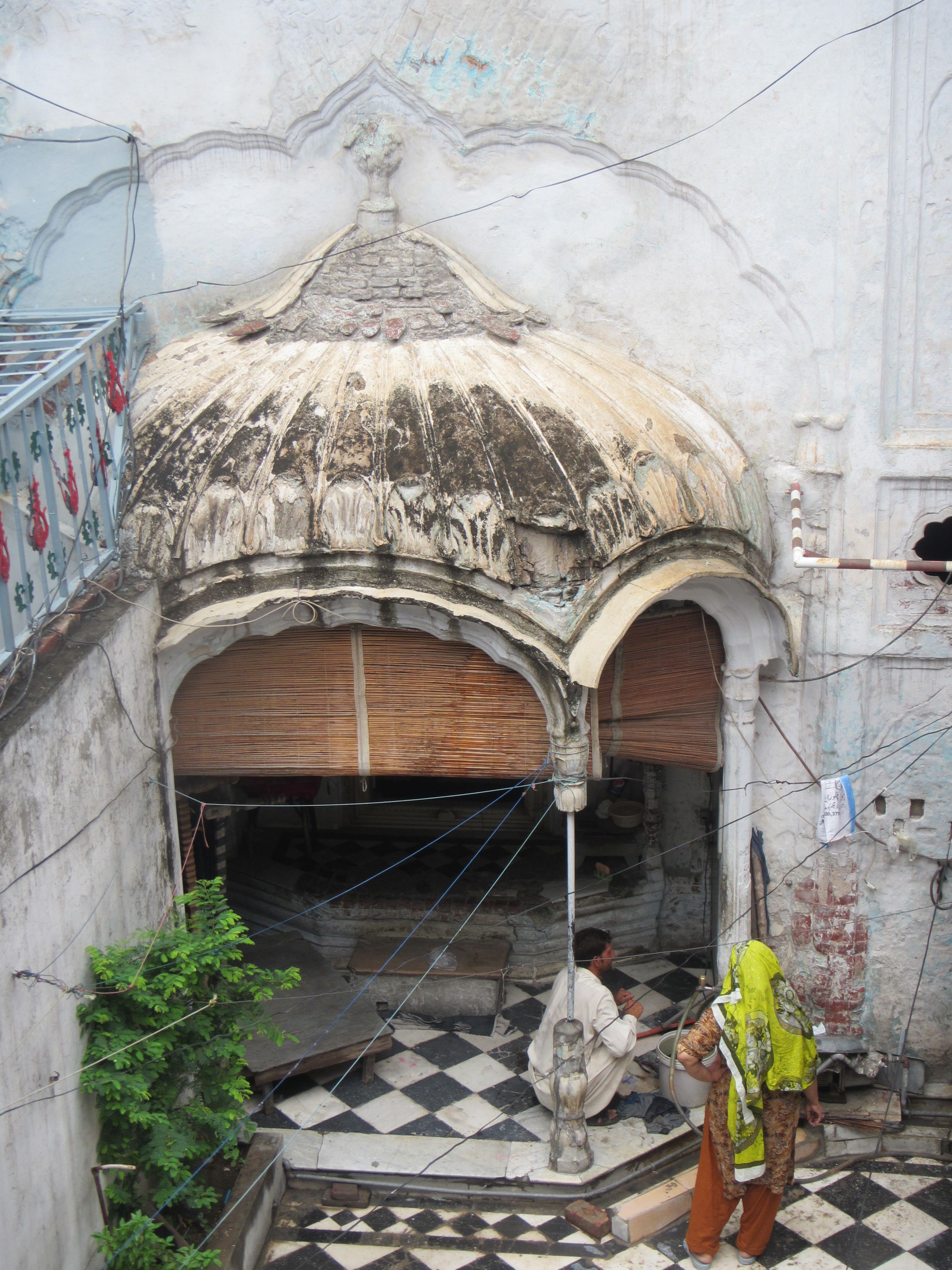
Western India and Pakistan are extremely rich in archaeological and cultural heritage sites, which span in date from the earliest villages, through several phases of urbanism, the rise and fall of numerous historical states and empires, and up to the colonial and modern periods. Today, many areas are densely occupied and undergoing rapid development, and while archaeological and cultural heritage sites and monuments in Pakistan and India are protected in principle, in practice they are often viewed as impediments and obstacles.
Many sites are at risk, typically from factors including erosion, large-scale development, looting, and perhaps most significantly, the expansion of extensive irrigation agriculture and the concomitant levelling of large tracts of land. Site destruction has been observed in the field and is ongoing, and the level and rate of site lost is not being monitored.
Past and current research
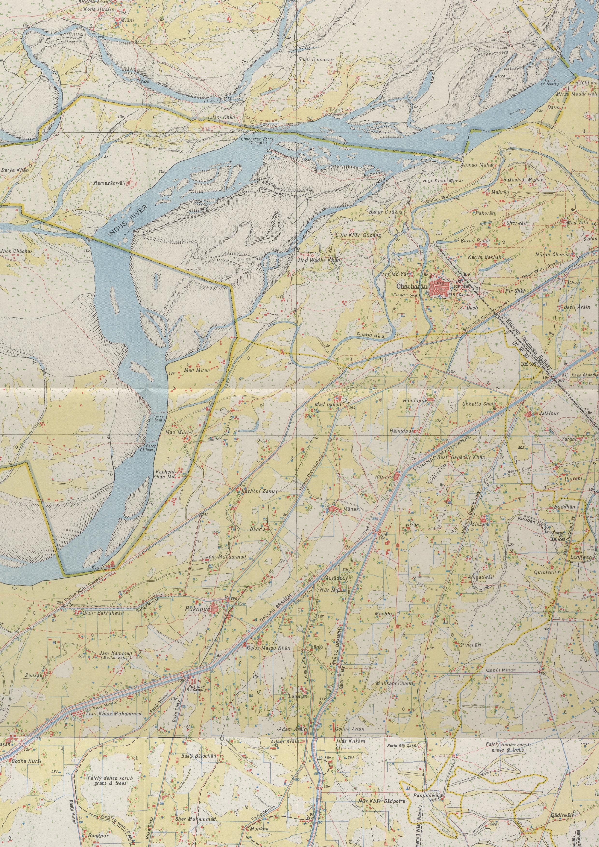
Since the 1950s and 1960s, academic books and journals have published lists of archaeological sites discovered in western India and Pakistan, and scholars have attempted to compile these data and use it to draw conclusions about the ancient societies in South Asia. Since 2008, Cambridge-based researchers have reviewed the published archaeological settlement data for the Indus River Basin as a whole. Ground-truthing in northwest India has demonstrated that there are significant inaccuracies with much of the current primary site location data. Systematic approaches have not been common and there are substantial gaps in spatial coverage. These factors combine to limit our understanding of the distribution of archaeological and cultural heritage in the region, and make it difficult to manage and protect this resource.
An open digital workflow
The MAHSA approach combines remote sensing, historic mapping and machine-based algorithms to collect, assess, refine, systematise and import archaeological and cultural heritage site data, making it possible to identify sites that have not previously been documented, highlight sites that are in danger, and monitor the impact of development and agriculture.
To do this, the project team is:
- Comprehensively assessing, collating and systematising the published legacy data on archaeological site locations, and the associated field data, research, and bibliographic information for all known archaeological sites in Pakistan and western India
- Identifying and documenting previously unidentified sites, using historic maps, remote sensing and automated site detection methods
- Cross-checking and expanding the data on site locations through identifying ‘signatures’ of both known and previously unidentified and unrecorded archaeological and cultural heritage sites. These will be identified through systematic analysis of historical maps, publicly available satellite and remote sensing imagery, digital elevation models provided by the German Space Agency (DLR), and automatic site detection algorithms
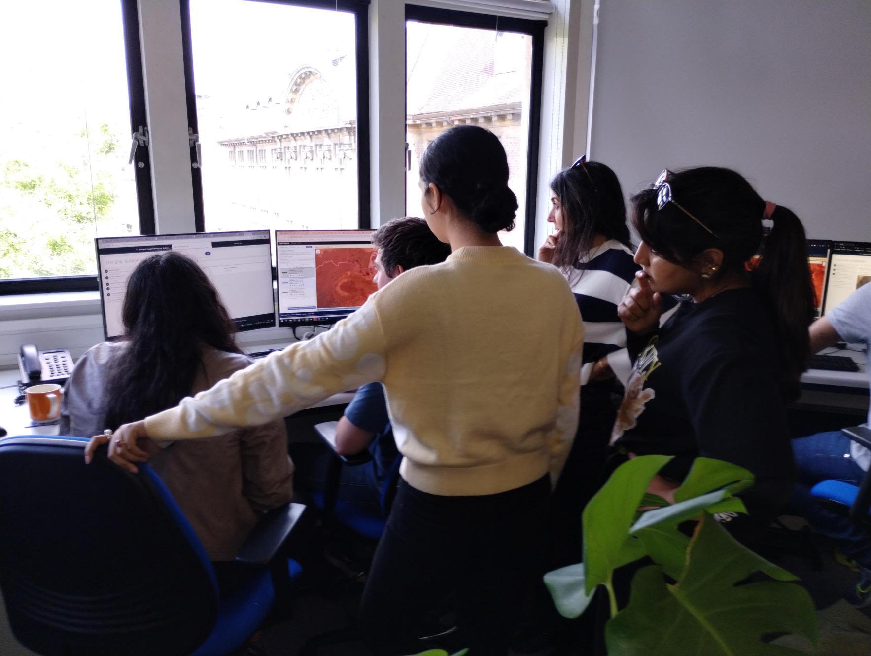
- Collaborating with local stakeholders to provide training in GIS, methods of site detection, recording of sites on the ground, and detailed site documentation.


Database
An Open Access geospatial database based on Arches 5 is being tailored to the specifics of the project and the needs of the local stakeholders.
The MAHSA Arches database is being tailored using the open source Arches software platform. Arches has been developed by the Getty Conservation Institute and World Monuments Fund for cultural heritage data management.
It has a variety of features and capabilities for data management, discovery and visualisation, and allows for flexible customisation of the data model.
The MAHSA Arches database and data model
To help ensure that the information on archaeological and cultural heritage sites in the database matches stakeholders’ requirements and expectations, the precise details of entries are being developed with the project collaborators. These will include:
- Location, size, shape, periods of occupation and degree of preservation and risk level
- Where available, map images, photographs, features that have been observed and associated finds
- Bibliographic information, including links to Open Access publications, for sites that that have been previously surveyed, excavated and/or studied.
For data collection in the field and ground-truthing of the sub-set of data, a customised digital field survey form is being developed using open source Open Data Kit (ODK) software.
ODK allows offline data collection, using mobile phones or tablets, in resource-constrained environments. The collected data can be uploaded to a server when an internet connection is available. The forms are structured along several checks and constraints that will minimise the possibility of data collection errors. We are also exploring the Arches Collector app for future data collection.


Resources
As part of MAHSA we are developing a resources library to be used by researchers and heritage professionals, based on the materials developed for our training and workshops.
These resources are based on the techniques and methodologies used and developed by the project team, from maps digitisation and data modelling to remote sensing and machine learning, to identify, document and monitor the archaeological heritage of South Asia.
Workshops
We have held a number of online workshops organised jointly with the MAEASaM project, covering remote sensing, databases and the use of historic maps for archaeological research.
Remote Sensing Workshop in Archaeology

MAHSA Blog

Pattan Minar: A Warning to the Curious
By Afifa Khan and Rosie Campbell, April 15, 2022
Working with Brown History, Afifa and Rosie wrote this blog about Pattan Minar and other archaeology of the region.

Cropping Maps with QGIS and Python
By Jack Tomaney, May 15, 2022
Thanks to the hard work of our RA Jack, we now have a new tool for the project - a QGIS plugin that detects the edges of georeferenced Survey of India maps and crops them. This produces a beautiful mosaic of tessellating map sheets!

Story Maps: Surveyor Stories Part I
by Indu Prasad, Afifa Khan & Rosie Campbell, July 17, 2024
The Indians who mapped the archaeology of South Asia

Story Maps: For Official Use Only: The Survey of India in WWII
By The MAHSA Team
A survey of India's indispensable role in the World Wars

Click here to see what the MAHSA team has been getting up to in our live Georeferencing Progress map. Click any of the maps or to zoom in and out, and explore the data!

MAHSA TEAM
The MAHSA project benefits from the deep knowledge and expertise of colleagues in a number of South Asian and European institutions.
A core team based at the University of Cambridge is coordinating the project, and is working with colleagues in two partner institutions, the Catalan Institute of Classical Archaeology (ICAC) and the Universitat Pompeu Fabra, Barcelona (UPF). The project is also collaborating with government bodies and academic institutions in both Pakistan and India, including the Directorate of Archaeology and Museums, Khyber Pakhtunkhwa; the Indian Institute of Technology Gandhinagar; the University of Kerala; and the University of the Punjab.
As the work progresses, we will continue to forge links across heritage management and research communities in order to build knowledge and advance the ultimate goals of the project: to document, disseminate, protect and preserve.
|
|
Junaid Abdul Jabbar |
Research Assistant/Database Coordinator |
|
|
|
Aftab Alam |
Project Collaborator |
|
|
|
Samia Anwar |
Project Collaborator Archaeologist, Assistant Controller of Examination, University of Chakwal, Punjab, Pakistan |
|
|
|
Iban Berganzo Besca |
Project Collaborator
|
|
|
|
Rosie Campbell |
Research Assistant |
|
|
|
Sandeep Dixit |
Project Collaborator Director of The Centers for International Projects Trust, New Delhi |
|
|
|
Moazzam Khan Durrani |
Project Collaborator Lecturer at Islamia University of Bahawalpur's Department of Anthropology |
|
|
|
Abhayan G. S. |
Project Collaborator Assistant Professor, Department of Archaeology, University of Kerala |
|
|
|
Petrus (Piet) J. Gerrits |
Research Assistant |
|
|
|
Ekta Gupta |
Project Collaborator Post-Doctoral Researcher at the Institut Català d'Arqueologia Clàssica |
|
|
|
Muhammad Hameed |
Project Collaborator |
|
|
|
Zakirullah Jan |
Project Collaborator Professor at the University of Peshawar, Department of Archaeology |
|
|
|
Samia Khalid |
Project Collaborator Associate Professor / Chairperson The Islamia University of Bahawalpur Pakistan |
|
|
|
Afifa Khan |
Research Assistant |
|
|
|
Navjot Kour |
Project Collaborator |
|
|
|
Marco Madella |
Project Partner |
|
|
|
Muhammad Waqar Mushtaq |
Project Collaborator Lecturer in the Department of History at The Islamia University Bahawalpur, Pakistan |
|
|
|
Hector Aleix Orengo |
Project Partner Associate Researcher in Computational Social Sciences at Barcelona Supercomputing Center |
|
|
|
Cameron Petrie |
Principal Investigator |
|
|
|
V.N. Prabhakar |
Project Collaborator |
|
|
|
Rebecca Roberts |
Project Coordinator |
|
|
|
Rajesh S.V. |
Project Collaborator |
|
|
|
Abdul Samad |
Project Collaborator |
|
|
|
Mou Sarmah |
Research Assistant |
|
|
|
Vikas Kumar Singh |
Project Collaborator |
|
|
|
Ravindra Nath Singh |
Project Collaborator |
|
|
|
Kuili Suganya Chittiraibalan |
Research Associate (Remote sensing and survey: India) Indian Institute Of Technology Gandhinagar |
|
|
|
Jack Tomaney |
Research Assistant |
|
|
|
Shakir Ullah |
Project Collaborator Professor and Chairman at the Department of Archaeology, Hazara University |
|
|
|
Azadeh Vafadari |
Research Associate/Training Coordinator |
|
|
|
Vaneshree Vidyarthi |
Research Assistant |
|
|
Thank you to former colleagues who contributed to the MAHSA project |
|||
|
|
Adam Green |
Project Collaborator |
|
|
|
Maria Suarez-Moreno |
||
|
|
Jonas Gregorio de Souza |
||
|
|
Pangambam Sendash Singh |
||


News


New Workshop Videos now Live!
The MAHSA Team, in collaboration with MAEASaM have hosted two new workshops where our experts spoke to participants about archaeological data management practices in Workshop 5 and archaeological data digitization in Workshop 6. Check out the recordings on our YouTube Channel - @mahsa_maeasam


Applications of GIS in Archaeology and Heritage Workshop at IIT Gandhinagar, Gujarat, India
11 December, 2024
Earlier this month MAHSA held a 5-day training workshop for students, PhD researchers, archaeologists and geologists hosted at IIT Gandhinagar, Gujarat, India.
Experts gave a variety of presenrations on the Applications of GIS in Archaeology and Heritage with a mixure of case studies, theory and practical sessions.
MAHSA makes the move to BlueSky
5 December, 2024
MAHSA has joined the new Twitter-like social media platform BlueSky. Come and visit our page @mahsa-project.bsky.social
MAHSA leaves Twitter/X
20 November, 2024
MAHSA has made the decision to leave the social media platform X and focus our energy on platforms which foster positive engagement.
We will be continuing to post on Facebook, Instagram, LinkedIn, YouTube and BlueSky.
FURTHER READING
Listed here are a number of publications which are either the result of our project's work or which offer some further details about the background to our project and the methods we use.
Bates, J., Morrison, K.D., Madella, M., Hill, A.C., Whitehouse, N.J., Abro, T., Ajithprasad, P., Anupama, K., Casile, A., Chandio A., Chatterjee, S., Gangopadhyay, K., Hammer, E., Haricharan, S., Hazarika, M., Korisettar, R., Kumar, A., Lancelotti, C., Pappu, S., Parque, O., Petrie, C.A., Premathilake, R., Selvakumar, V., Sen, S., Spate, M., Trivedi, M., Veesar, M., and Vinayak. V. 2025. Early to Mid-Holocene land use transitions in South Asia: a new archaeological synthesis of potential human impacts, PLoS ONE 20(2): e0313409 [online 13/02/2025; DOI: https://doi.org/10.1371/journal.pone.0313409]
Berganzo-Besga, I., Orengo, H.A., Lumbreras, F. et al. Curriculum learning-based strategy for low-density archaeological mound detection from historical maps in India and Pakistan. Sci Rep 13, 11257 (2023). https://doi.org/10.1038/s41598-023-38190-x
Conesa, F.C., Orengo, H.A., Lobo, A., and Petrie, C.A. 2022. An Algorithm to Detect Endangered Cultural Heritage by Agricultural Expansion in Drylands at a Global Scale, Remote Sensing 15(1), 53 [DOI: https://www.mdpi.com/2072-4292/15/1/53].
Garcia-Molsosa, A., Orengo, H.A., Lawrence, D., Hopper, K., Philip, G. and Petrie, C.A. 2021. Potential of deep learning segmentation for the extraction of archaeological features from historical map series, Archaeological Prospection 28.2: 187-199 [http://dx.doi.org/10.1002/arp.1807].
Garcia-Molsosa, A., Orengo, H.A. and Petrie, C.A. 2023. Reconstructing long-term settlement histories on complex alluvial floodplains by integrating historical map analysis and remote-sensing: an archaeological analysis of the landscape of the Indus River Basin, Heritage Science 11.141 [online 10/07/2023; DOI: https://heritagesciencejournal.springeropen.com/articles/10.1186/s40494-023-00985-6].
Giesche, A., Hodell, D.A., Petrie, C.A., Haug, G.A., Adkins, J.F., Plessen, B., Marwan, N., Bradbury, H.J., Hartland, A., French, A.D. Breitenbach, S.F.M. 2023. Recurring summer and winter droughts from 4.2-3.97 thousand years ago in north India, Nature Communications Earth & Environment 4, 103 [online 04/05/2023; DOI: https://doi.org/10.1038/s43247-023-00763-z].
Petrie, C.A., Bates, J., Higham, T. and Singh, R.N. 2016. Feeding ancient cities in South Asia: dating the adoption of rice, millet and tropical pulses in the Indus Civilisation, Antiquity 90.354: 1489-1504 [doi: https://doi.org/10.15184/aqy.2016.210].
Petrie, C.A., Singh, R.N., Bates, J., Dixit, Y., French, C.A.I, Hodell, D., Jones, P.J., Lancelotti, C., Lynam, F., Neogi, S., Pandey, A.K., Parikh, D., Pawar, V., Redhouse, D.I., Singh, D.P. 2017. Adaptation to variable environments, resilience to climate change: investigating Land, Water and Settlement in northwest India, Current Anthropology 58.1: 1-30 [http://www.journals.uchicago.edu/doi/full/10.1086/690112].
Petrie, C.A. and Bates, J. 2017. ‘Multi-cropping’, intercropping and adaptation to variable environments in the Indus Civilisation, Journal of World Prehistory 30: 81-130 [https://doi.org/10.1007/s10963-017-9101-z].
Orengo, H.A. and Petrie, C.A. 2017. Large-scale, multi-temporal remote sensing of palaeo-river networks: a case study from northwest India and
its implications for the Indus Civilisation, Remote Sensing 9.735 [doi: https://doi.org/10.3390/rs9070735].
Orengo, H.A. and Petrie, C.A. 2018. Multi-Scale Relief Model (MSRM): a new algorithm for the analysis of subtle topographic change in digital
elevation models, Earth Surface Processes and Landforms [online first 14 December 2017; doi: https://doi.org/10.1002/esp.4317].
Green, A.S. and Petrie, C.A. 2018. Landscapes of urbanisation and de-urbanization: integrating site location datasets from northwest India to investigate changes in the Indus Civilization’s settlement distribution, Journal of Field Archaeology [online first May 11, 2018; https://doi.org/10.1080/00934690.2018.1464332].
Garcia, A., Orengo, H.A., Conesa, F.C., Green, A.S. and Petrie, C.A. 2019. Remote Sensing and historical morphodynamics of alluvial plains: the 1909 Indus flood and the city of Dera Ghazi Khan (Province of Punjab, Pakistan), Geosciences 9.1.21 (1-26) [online first 29 December 2018; DOI: https://doi.org/10.3390/geosciences9010021].
Green, A.S., Singh, R.N., Alam, A., Garcia, A., Green, L.M., Conesa, F., Orengo, H.A., Ranjan A., and Petrie, C.A. 2019. Re-discovering dynamic ancient landscapes: archaeological survey of mound features from historical maps in northwest India and their implications for the large-scale distribution of settlements in South Asia, Remote Sensing 11(18), 2089 [DOI: https://www.mdpi.com/2072-4292/11/18/2089/pdf;
https://doi.org/10.3390/rs11182089].
Petrie, C.A., Orengo, H., Green, A.S., Walker, J.R., Garcia, A., Conesa, F., Knox, J.R. and Singh, R.N. 2019. Mapping archaeology while mapping an empire: using historical maps to reconstruct settlement landscapes in India and Pakistan, Geosciences 9.1:11 (1-26) [online first 25 December 2018; DOI: https://doi.org/10.3390/geosciences9010011].
Petrie, C.A. and Lynam, F. 2019. Revisiting settlement contemporaneity and exploring stability and instability: case-studies from the Indus Civilisation, Journal of Field Archaeology 45.1: 1-15 [accepted 15/07/2019;DOI: https://doi.org/10.1080/00934690.2019.1664848].
Hector A. Orengo, Francesc C. Conesa, Arnau Garcia-Molsosa, Agustín Lobo, Adam S. Green, Marco Madella, Cameron A. Petrie. 2020. Automated detection of archaeological mounds using machine-learning classification of multisensor and multitemporal satellite data, PNAS 117.31:
18240-18250 [DOI: https://doi.org/10.1073/pnas.2005583117 ].
Petrie, C.A., Lightfoot, E., Jones, P.J., Walker, J.R., Valentine, B.T., Krigbaum, J., le Roux, P., Joglekar, P.P., Shinde, V., Singh, R.N., and O’Connell, T.C. 2024. Animal movement on the hoof and on the cart and its implications for understanding exchange within the Indus Civilisation. Scientific Reports 14.158. [online 02/01/2024; DOI: https://doi.org/10.1038/s41598-023-50249-3]